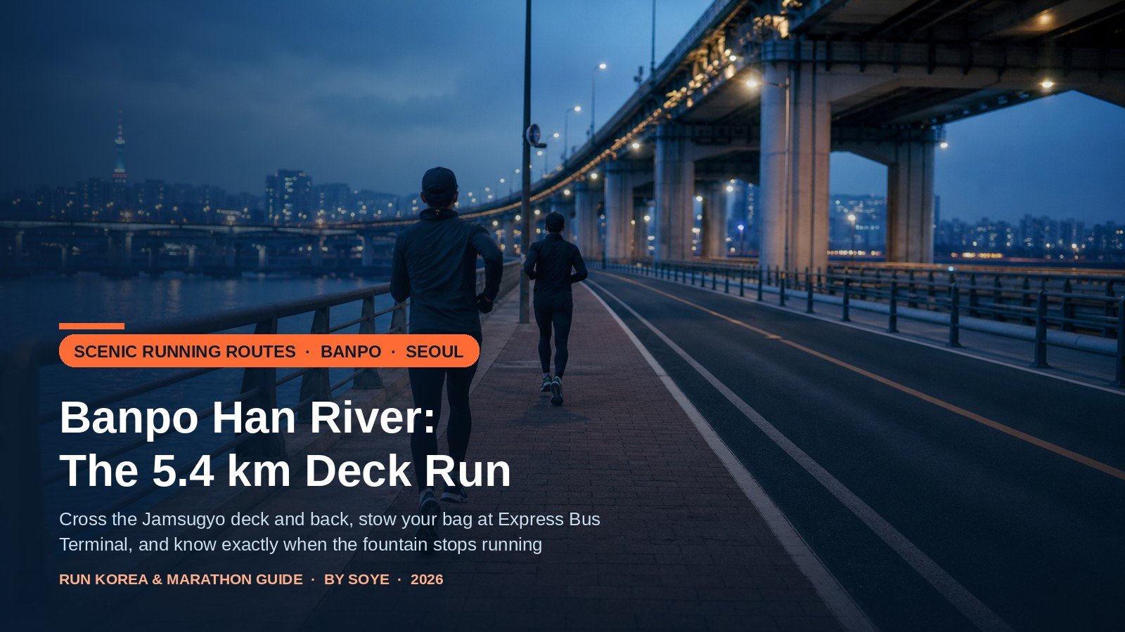
At 18:40 on a weekday the last 200 metres of the Jamsugyo Bridge are doing three jobs at once: a couple posing against the bridge lights, a cyclist holding 28 km/h in the marked lane, and a runner picking a line between them on the red paving. This is the most photographed run in Seoul — and the one most English guides describe from a photograph rather than from the bridge.
Three things about this loop are wrong in those guides. The bridge stopped carrying cars on 26 October 2026 and is being rebuilt as a pedestrian deck, with a total closure for walkers and cyclists in May to August 2027. The rainbow fountain that draws the crowds is off entirely from November to mid-March. And the convenience store everyone names as the post-run ramen stop, the one on Sebitseom, does not sell ramen.
The bridge changed in October 2026: Jamsugyo stopped carrying cars on 26 October 2026 and is being rebuilt as a pedestrian deck, with a total closure for walkers and cyclists in May–August 2027. The rainbow fountain is off entirely from November to mid-March, the Banpo course is a 5.4 km double out-and-back from Moonlight Plaza, and every outdoor fountain on the river is off in winter.
Quick Verdict
Banpo’s signature run is a 5.4 km double out-and-back from Moonlight Plaza: 795 m across Jamsugyo and back, then west to Dongjak Bridge and back. Leave your bag in a T-Locker at Express Bus Terminal, run on the red paving, and carry water from November to March.
In This Guide
- The Course: What 5.4 km Actually Means
- Jamsugyo Rules That Changed in October 2026
- The Fountain Calendar, and What Winter Really Gives You
- Getting In, Lockers and the Underground Route
- Winter Water: Every Fountain Is Off
- Post-Run Ramen: The Two Stores That Actually Cook
- Checklist
- Frequently Asked Questions
The Course: What 5.4 km Actually Means
Seoul publishes this route itself. The city’s 7979 Seoul Urban Running Crew programme lists four Banpo courses, all starting at Moonlight Plaza (달빛광장), and the middle one is called simply Han River–Jamsugyo: 5.5 km, with the waypoints written out — Moonlight Plaza, the north end of Jamsugyo (turn), Seorae Island, Dongjak Bridge (turn), Moonlight Plaza. Watches and phone apps on the same route usually read 5.4 km, because the plaza is a wide space and everyone starts measuring from a different paving slab. Either number is the same run.
What the sheet does not spell out is that this is not a closed loop. It is two out-and-backs stacked end to end: one across the river, one along it. That shape is why the course suits a visitor. You never cross a road, you can turn at any point and finish where you started, and both bail-outs — the far end of the bridge, Dongjak Bridge — are landmarks rather than map pins.
If 5.4 km is a warm-up, extend north: from the Jamsugyo north landing the riverside path runs east under the elevated road to Hannam Bridge (about 5 km round trip) or on to Dongho Bridge at Oksu (about 8 km), and it is the driest running in Seoul in rain. For a flat loop with a different skyline the Yeouido 8.4 km loop is the direct comparison; for the opposite of flat, the Namsan north ring loop and its 160 m of climb.
| Segment | Distance | Surface | Gradient | What will catch you |
|---|---|---|---|---|
| Moonlight Plaza to the Jamsugyo ramp | ~0.2 km each way | Interlocking block paving | Flat | Picnic crowds at weekends; the cycle path crosses your line at the ramp, so look both ways before you swing onto the bridge |
| Jamsugyo deck | 795 m each way (1.6 km return) | Red block paving for walkers; asphalt lane for bicycles | Dead flat, 2.7 m above the water | Crosswind, fountain spray in season, black ice in the cold, cyclists at 20–30 km/h in the lane beside you |
| West leg: Plaza, Seorae Island, Dongjak Bridge | ~1.9 km each way (3.8 km return) | Asphalt promenade and block paving | Flat, one short ramp onto the island bridge | No shelter and fewer lights on the western approach; the river wind meets you on the way back |
| Total, official course | 5.4–5.5 km | All paved | Under 10 m of climb | It is two out-and-backs, so decide your turn points before you start |
Two measuring aids. The riverside cycle path has 1 km marker posts along its full 78 km, so you can set a custom distance without a watch. And the Banpo path carries a speed display that triggers above 20 km/h — which tells you what the bicycles beside you are doing: 20 km/h is a kilometre every three minutes, roughly twice your easy pace.
Whenever I run Banpo after the fountain season, I carry water and set my expectations accordingly. From November to mid-March the rainbow fountain is off and every drinking fountain on the path is dry, so the photograph everyone came for is a summer thing and the winter run is the red paving, the bridge and the skyline.
The bridge is the part to plan around this year. Cars stopped in October 2026 and the whole span closes to walkers and cyclists in May–August 2027, so any loop that crossed Jamsugyo in that summer needs rerouting via Dongjak — the 5.4 km course survives, the crossing does not.
Jamsugyo Rules That Changed in October 2026
The bridge under the fountain is easy to misread. Jamsugyo opened on 15 July 1976, is 795 m long and 18 m wide, and sits 2.7 m above the water where every other Han River crossing stands 16 to 20 m up. It was built to go under: when the river rises, the deck floods by design. In 2008 the city turned two of its four lanes — about 11 m across — into a walker strip and a cycle lane. That is the bridge in every photograph: red-brown block paving on the left, darker asphalt with bicycle markings on the right, the river level with your hip.
Then, on 26 October 2026, vehicle traffic stopped for good. Seoul has begun converting the bridge into its first pedestrian-only Han River crossing: wider walking decks, 22 viewing platforms, a transparent section over the water, completion planned for the second half of 2027. Walkers and cyclists keep using the bridge during the works, on a route separated from the construction area — with one exception that matters for next year. During the paving work between May and August 2027, pedestrians and cyclists are shut out entirely, and the nearest crossings become Dongjak Bridge to the west and Hannam Bridge to the east. A summer 2027 visit should plan the south bank only.
What has not changed is the discipline on the deck. Cyclists use it as a through route at speed; the walker strip is where you run, and stepping into the lane to pass someone is how visitors get shouted at.
The river still owns the bridge. At a water level of 5.5 m the walker and cycle crossing closes, measured on the gauge under the bridge, and 6.5 m puts the deck under water. On average it submerges about ten days a year. After heavy rain, and on the day after, run the bank and skip the crossing: the river can stay high for a day after the rain has stopped. Cold is the other local hazard — the deck is steel, the lowest and most exposed surface on the river, so it ices before the park paths do. If it is near zero and the pavement looks wet, it is not wet. The outsole grip guide explains why no rubber compound saves you on ice, and what to change instead.
The Fountain Calendar, and What Winter Really Gives You
The Moonlight Rainbow Fountain is why most people come, and why most English guides are wrong about this park. It is 1,140 m long, 570 m on each side of the bridge, fires from 380 nozzles at about 19 tonnes of water a minute, and was certified by Guinness World Records in 2008 as the world’s longest bridge fountain.
Its season is short. Seoul’s fountain page gives 15 March to 31 October, with a shorter timetable in the shoulder months; the park’s summary page rounds that to “April to October.” Either way, from 1 November to mid-March it is off completely — not reduced, not weather-dependent, off — because the pipework would freeze. Blogs that promise a winter show are describing a season that ended weeks earlier.
- Shoulder season (mid-March–May, October): 12:00, 19:30, 20:00, 20:30, 21:00, each show 20 minutes.
- Peak season (June–September): the same times plus 21:30.
- It stops without warning: wind at 7 m/s or more, rain forecast during a slot, or river turbidity above 15 NTU. A clear evening after a downpour can still be a no-show while the intake is checked.
- Same-day confirmation: the fountain control room, 02-3780-0578~9; park information centre, 02-3780-0541~4.
A winter evening here is not a wasted one, it is a different run: the bridge lighting does the work, the deck puts you close enough to hear the river, and the skyline over the north bank reflects in water that is usually glassy after dark. The crowds that block the deck in July are absent, which makes November and December the best months to run this route rather than walk it.
Getting In, Lockers and the Underground Route
Banpo Hangang Park has no lockers in its official facility list, and no changing rooms or showers, which is the first thing to solve. The park itself runs 7.2 km along the south bank between Hannam and Dongjak bridges, with an information centre roughly in the middle, open around the clock for enforcement and 09:00–18:00 for enquiries. The answer to the bag problem is one station away: Express Bus Terminal, on lines 3, 7 and 9, holds the nearest locker bank to the bridge.
Its T-Lockers — three banks and about 49 boxes, the biggest bank in the central B2 arcade — come in small (50 × 30 × 60 cm), medium (50 × 45 × 60 cm) and large (50 × 90 × 60 cm). For the first four hours a small box costs ₩2,200 on weekdays and ₩3,100 at weekends, medium ₩3,300 / ₩4,600, large ₩4,400 / ₩6,100, with ₩500–1,000 per extra hour. A small box takes a daypack, shoes and a jacket; a carry-on needs large.
| Where you arrive | Locker | Walk to the bridge | Toilets and shops | When to choose it |
|---|---|---|---|---|
| Express Bus Terminal, exits 8-1 / 8-2 (lines 3, 7, 9) | T-Locker, 3 banks / ~49 boxes, 05:00–24:00, ₩2,200–4,400 per 4 h weekday | 650 m, 10–15 min | Toilets at both exits; underground mall; convenience stores | Default for a visitor with a bag |
| Gotomall exit G2 (same station, underground) | Same banks, one level up | ~10 min, dry the whole way | Muralled public walkway to the park edge | Rain, or a night you would rather not spend above ground |
| Seobinggo Station, exit 2 (Gyeongui–Jungang line) | None | 8–10 min to the north landing | Nothing at the bridge end | Staying in Yongsan or Itaewon; start from the far end |
| Sebitseom / Moonlight Plaza (inside the park) | None | 0–3 min | Toilets, GS25, restaurants, information centre | Already here, or arriving by taxi |
Two rules decide your evening. The lockers run 05:00 to 24:00 only: outside those hours you cannot deposit or collect, so a 21:00 deposit means collecting by midnight. And no valuables, food or drink go in; anything left past five days is moved out.
- Deposit the bag before you warm up. Exit 8-1, down to the arcade level, pay at the T-Locker screen by card, and photograph the receipt number.
- Change at the station, not the park. The toilets beside exits 8-1 and 8-2 are the practical changing rooms; the park has none.
- Walk the 650 m as your warm-up. Straight along Banpo-daero — about 250 m, then 400 m — then the underpass beneath Olympic-daero, the “rabbit hole” locals mean when they say 반포 토끼굴.
- Start at Moonlight Plaza, under the Banpo Bridge deck, where there is light, a toilet and room to stretch.
- Cross on the red paving, turn at the far end, come back — then head west past Sebitseom towards Seorae Island and Dongjak Bridge.
- Collect the bag before midnight, and budget the extra hour: 4 h 20 min of locker time costs one hour’s fee.
For a shower the park cannot help. The nearest paid option runners use is Enduro Run Base (서초구 고무래로 18-4, B2), about 800 m from Express Bus Terminal exit 3, around ₩3,000 for shower and locker, 06:00–23:00, closed Mondays — community-reported, so confirm first.
Winter Water: Every Fountain Is Off
Seoul turns off its outdoor Arisu drinking fountains for the winter, with the 2026–27 shutdown running from 15 November to 15 March — roughly 1,880 fountains citywide, closed to protect the pipework from frost. Banpo’s are part of that number, so for four months the loop has no refill between the plaza and Dongjak Bridge.
The nearest water is retail: the park stores sell bottles at about ₩1,000–1,500, and the GS25 on Sebitseom is closest to the bridge. For 5.4 km that means carry 500 ml, or plan to pass the store twice; double the distance and you want a soft flask. Cold air hides thirst — you sweat less, feel less thirsty, and still lose fluid at much the same rate — so drink 300–500 ml before leaving the station. The toilets stay open, but their taps are not drinking water.
Post-Run Ramen: The Two Stores That Actually Cook
The most repeated Banpo advice online is to finish with instant noodles at the convenience store on Sebitseom. It does not work: that GS25 sells no bag ramen and no cup ramen, and visitors who cross the bridge expecting a cooker find a drinks-and-picnic shop. The two stores with cookers and aluminium pots are 7-Eleven Seorae Naru (Olympic-daero 2085-18, on the western stretch beside the toilets, with tables outside) and GS25 Banpo 2 (Sinbanpo-ro 11-gil 40, at the information-centre end, facing a wide lawn, with the bigger selection).
Expect ₩4,000–4,800 for bag ramen including the container and chopsticks, and ₩500–700 for an egg; the machine takes about four minutes. Hangang park stores run no 1+1 offers, card discounts or points — they are tendered at high rents, and Seoul only requires them to sit within 10 per cent of city prices on comparable goods, which the ramen sets are not.
For recovery rather than comfort, noodles are carbohydrate and salt and not much else. On a long-run day, eat properly within the hour: the high-protein recovery guide covers the 24-hour gukbap shops and convenience-store combinations near this park. And if this loop is the start of a block rather than the end of one, the 2027 Daegu Marathon entry guide has the February date and the entry windows that a winter of Banpo laps would be training for.
Checklist
- Bag in a T-Locker before you warm up, receipt photographed, collection noted: the lockers shut at 24:00.
- 500 ml of water carried between 15 November and 15 March, when every fountain is off.
- Fountain season checked: 15 March–31 October, and not in wind or rain.
- River level checked after heavy rain — 5.5 m closes the bridge crossing.
- Bridge status checked for 2027: walkers and cyclists shut out May–August.
- Red paving underfoot, cycle lane clear, crossing only where you can see both ways.
- A light for the western leg, where the promenade darkens past Seorae Island.
- ₩20,000 in a pocket: locker, water, noodles, one extra hour.
Frequently Asked Questions
Is the Banpo run 5.4 km or 5.5 km?
The same course. Seoul’s running-crew programme publishes 5.5 km from Moonlight Plaza with turn-backs at the north end of Jamsugyo and at Dongjak Bridge; watches usually read 5.4 km, because the plaza is wide and everyone starts from a different point. Plan 5.5 km.
Is it a loop, or do I run back the same way?
You run back. It is two out-and-backs joined at Moonlight Plaza — one across the bridge, one along the south bank — so there are no road crossings and two obvious places to turn early.
Can I still cross Jamsugyo now that cars are banned?
Yes. Vehicles stopped permanently on 26 October 2026 so the bridge can be rebuilt as a pedestrian deck, and walkers and cyclists keep using it on a separated route. The exception is the paving phase in May–August 2027, when it closes to everyone and you cross at Dongjak or Hannam Bridge.
Will I see the rainbow fountain in winter?
No. It runs 15 March–31 October and is switched off entirely from November to mid-March to protect the pipes. Winter still gives you the bridge lighting, the open water and the skyline. Confirm same-day shows on 02-3780-0578~9.
Where do I leave my bag, and can I shower?
The park has no lockers and no shower. Use the T-Lockers at Express Bus Terminal — ₩2,200 small, ₩3,300 medium, ₩4,400 large for four weekday hours, open 05:00–24:00, not overnight — then walk 650 m. For a shower, Enduro Run Base near exit 3 charges about ₩3,000, 06:00–23:00, Mondays closed.
Are the drinking fountains working in winter?
No. Seoul shuts outdoor drinking fountains from 15 November to 15 March, roughly 1,880 of them, Banpo included. Buy water at the park stores for ₩1,000–1,500 or carry a flask.
Final Summary
- The run: 5.4–5.5 km from Moonlight Plaza — 795 m across Jamsugyo and back, then west to Dongjak Bridge and back. Two out-and-backs, no road crossings, under 10 m of climb.
- The bridge: car-free since 26 October 2026 and under construction until late 2027, with a full closure for walkers and cyclists in May–August 2027. Red paving only; the asphalt lane belongs to bicycles at 20–30 km/h.
- The season: fountain 15 March–31 October, shows at 12:00, 19:30, 20:00, 20:30 and 21:00 (21:30 in summer), off entirely in winter and cancelled in wind, rain or muddy water.
- The logistics: T-Locker at Express Bus Terminal, ₩2,200–4,400 for four hours, 05:00–24:00; 650 m to the bridge; no lockers or showers in the park.
- Water and noodles: every fountain off 15 November–15 March, so carry 500 ml; ramen cookers only at 7-Eleven Seorae Naru and GS25 Banpo 2 — never the store on Sebitseom.
Last checked: 18 November 2026. Sources: Seoul’s Future Hangang Headquarters pages for Banpo Hangang Park and the Moonlight Rainbow Fountain; Seoul Metro’s T-Locker page and the city’s station locker data; Seoul’s 13 October 2026 announcement on the Jamsugyo pedestrian bridge; the 7979 Seoul Urban Running Crew course list; river-level rules for Jamsugyo; the winter fountain shutdown; and 2026 reports of the park’s stores and ramen prices.
Note: This is planning information for international runners, not advice from the park authority. Construction phasing, fountain shows and river closures change with weather and works, so confirm the bridge and the fountain on the day. Where a detail is not published, this guide says so rather than guessing.
2 thoughts on “Banpo Han River Running Guide: Jamsugyo Loop & Lockers (2026)”